
By John DiConsiglio
From 300 miles above the ground, Accra, Ghana, looks like most major cities. A satellite image shows a network of lines and rectangles, representing roads and buildings. To the untrained eye, the Western African capital could well be a Google Earth map of any urban spot on the globe.
But Ryan Engstrom, associate professor of geography, director of the Center for Urban and Environmental Research and holder of a Columbian College Dean’s Research Chair, sees something quite different when he looks at the view from space. Those lines cutting through the city are curved instead of straight, indicating this section of Accra lacks a well-maintained road system. Minimal right angles and corners distinguish well-constructed buildings from slum shacks. There’s sparse vegetation and high-population density. In fact, an image of a two-mile stretch can enable experts to make estimates on factors like literacy rates, unemployment figures, electricity use and trends in maternal and child health.
Satellite imagery has long been a vital tool for the defense and intelligence industries, disaster relief agencies, urban planners, environmental monitors and news reporters. But today, thanks to technology breakthroughs and an explosion in the amount of data available to researchers, once hard-to-obtain imagery is now used for everything from archaeological expeditions to finding your quickest route to work.
“The introduction of Google Earth has made it much easier to explain what we actually do,” said Engstrom, who uses high-spatial resolution satellite data to map slums in developing world cities. “We take the kind of visual imagery you see on Google Earth and we devise ways to automatically extract important information from it.”
Efforts by scientists like Engstrom to diagram the surge in urbanization around the world may have a profound impact on issues like pollution, public health, water, land use and quality of life. “Cities are growing and changing incredibly fast,” he said. And recent changes in the satellite science world have provided Engstrom with troves of new resources—and some intimidating new obstacles as well. In the past, researchers like him have been thwarted by the prohibitive expense of obtaining good images when they are available. But in the last few years, the government has reinterpreted its license agreements with commercial satellite vendors to make an archive of images freely available to federally-funded researchers.
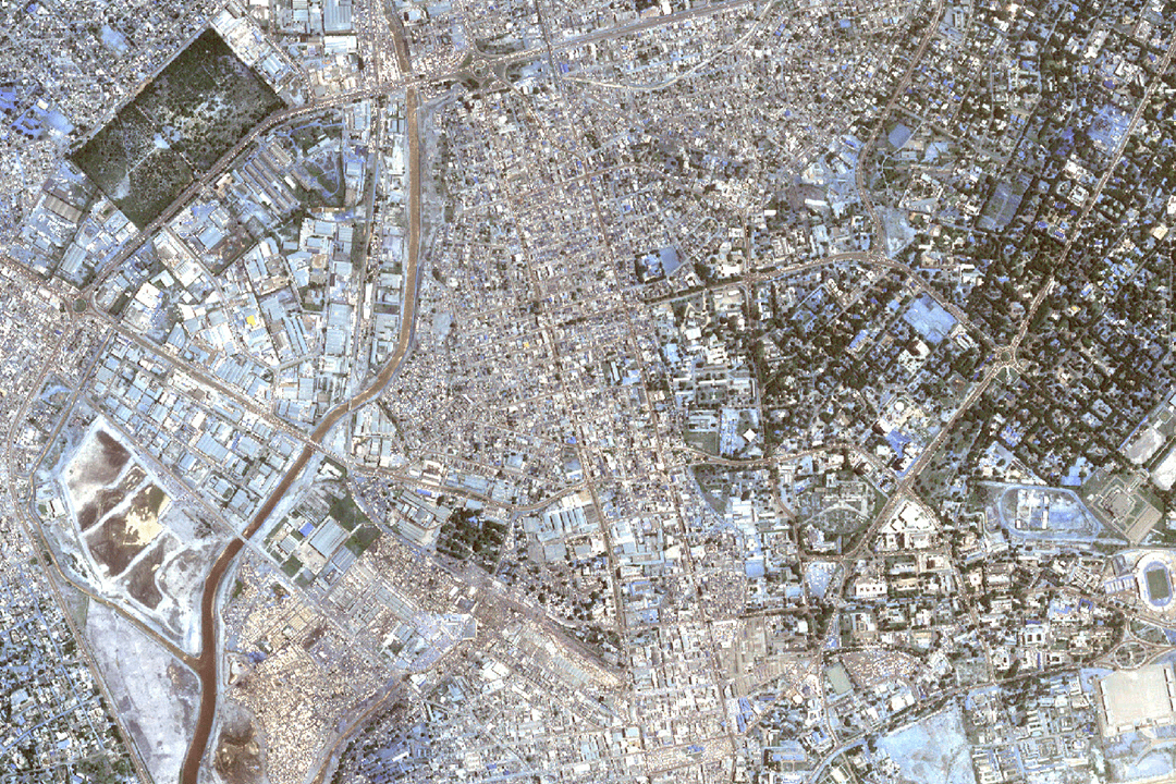 A high-spatial resolution satellite image of a 2-3 mile stretch of Accra, taken from 300 miles in space. (Photo Courtesy Ryan Engstrom) |
Engstrom’s work has been supported by grants from NASA, the National Science Foundation and the National Institutes of Health (NIH). After years of struggling to afford data, he suddenly had thousands of high-resolution images at his fingertips at no cost. In 2006, for example, as part of an NIH-funded project, Engstrom purchased a small image of Accra for $15,000. This year, he was provided 300 free images encompassing the entire country of Ghana taken over the last decade—approximately two terabytes of data that would have cost more than $1 million a few years ago.
“The landscape has completely changed,” Engstrom said. “We can now take areas that were once, from an imaging perspective, blank canvases and fill them in with information that will lead to transformative breakthroughs in how we understand, study and manage urban environments.”
But having access to vast stores of information does have its price. Processing the “big data” from the satellite images is extraordinarily complex and time consuming. “There are thousands of images taken every day,” Engstrom explained. “You can't sit down and look at them all. It’s become more and more important to create an automated process that extracts the crucial information we need.”
To solve the problem, Engstrom and his colleagues are taking computer algorithms originally developed for facial recognition software and applying them to satellite images. The novel approach is proving to be more accurate, adaptable and quicker than previous methods.
“Ryan Engstrom's research is cutting edge and it has the potential for a real impact in developing cities,” said Avery Sandborn, MA ’15, Engstrom’s former research assistant and a spatial analyst with the U.S. Department of Agriculture. In fact, Sandborn has employed the techniques she learned in Engstrom’s geography lab to her current position and at past projects with The World Bank.
Urban Explosion
|
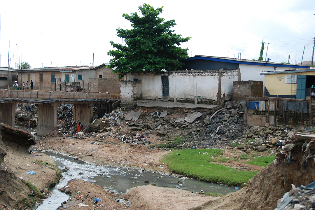
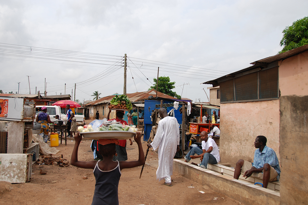
On the ground, Accra is plagued by poor living conditions and hazards such as flooding, open sewers and industrial waste. (Photos: Sarah Antos) |
Since 2007, Engstrom has aimed his satellite sights on cities like Accra as an example of the massive growth of urbanization around the world. For the first time in history, more than half the world’s population now resides in cities. The United Nations estimates that 60 percent of all people will be urbanized by 2030. “We are becoming an urban population and it’s rapidly reshaping the world,” Engstrom said.
In the developing world, many of the burgeoning cities’ dwellers live in conditions that the U.N. defines as slums, with high incidents of poverty, unemployment and illiteracy, and exposure to environmental hazards such as flooding, open sewers and industrial waste. More than 32 percent of the global developing regions’ urban population lives in slums. Using the U.N.’s strictest definition of a slum, that figure rises to over 60 percent in sub-Saharan Africa and as high as 80 percent of the two million residents of Accra, Engstrom said.
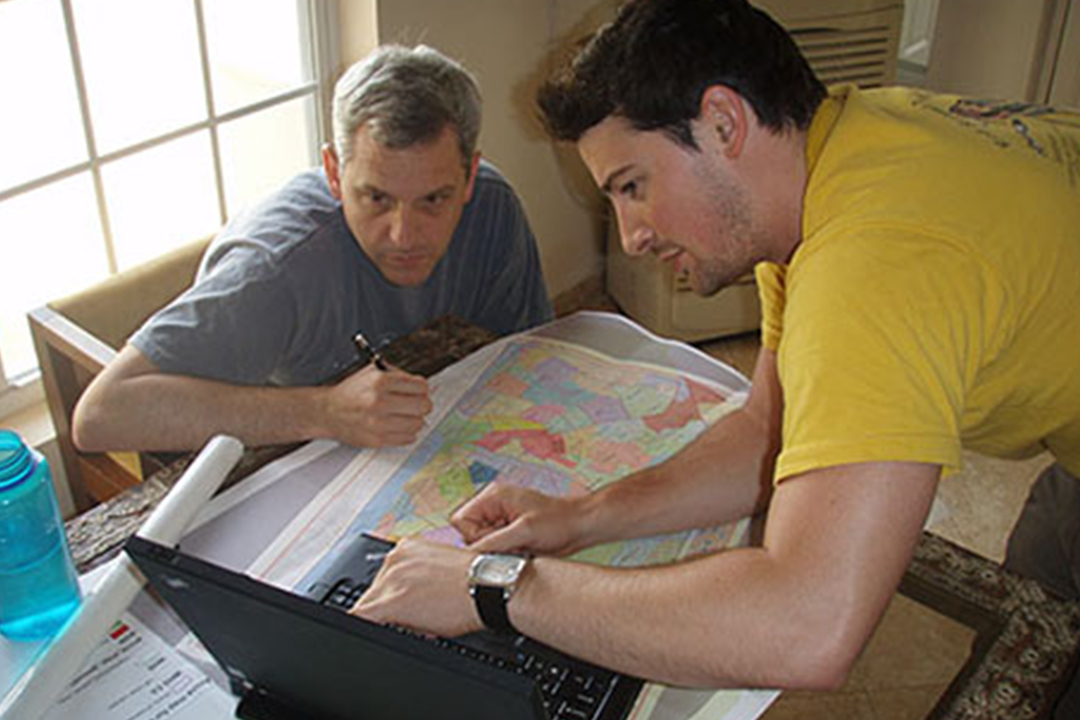
Engstrom and his student research teams—which currently includes a master’s and a postdoctoral student—have traveled to Ghana to “walk the slums” of Accra, he said. “An image from space can give you a lot of information, but you need to meet the people on the ground.” Although Ghana is considered one of Western Africa’s most stable democracies and it produces relatively high-quality census data for the region, the sprawling city of Accra defies easy classification. “In Accra, there are million-dollar houses just a few miles away from people living in shacks,” Engstrom said. Engstrom’s team has viewed neighborhood streets flooded with sewer water and sanitation. In some of the most densely populated areas, extended families sleep in shifts, with up to 10 people per room in areas with trash-strewn alleys and courtyards.
But conducting on-the-ground surveys in developing countries is costly and not always up to date. “Remote sensing presents a timely and effective way to monitor populations as they experience rapid urbanization,” said Sanborn. “Being able to target where vulnerable communities live assists with slum upgrading development plans and disaster relief.”
From space, the high spatial resolution satellite images can provide a clear cross section of cities like Accra. Using the modified facial recognition software, researchers can isolate spatial characteristics that pinpoint slums—like the curved lines of poor roads or the irregular shapes of slum shelters. “We are, in effect, inferring the quality of life within an urban area from satellite observations,” Engstrom said.
As a Dean’s Research Chair, Engstrom is expanding his data collection and examination, and has compared notes with international colleagues at conferences in Switzerland and Italy. The next step, he said, is to refine the software to isolate only the most important geographic data.
“Our biggest challenge is determining exactly what matters most in thousands and thousands of images,” he said, “and finding that information as quickly and as accurately as possible.”