
In East Jerusalem, Palestinian and Israeli residents live very close to each other, but their interactions are often limited. As a Luther Rice Undergraduate Research Fellow, Aurora Echavarria tackled the unique sensitivities of the city by analyzing how past conflicts between the two peoples have affected Jerusalem’s physical environment and exacerbated tension. While working to map out the areas of interaction for her fellowship project, she came to better understand why Jerusalem, in essence, is two very different cities operating as one.
“Jerusalem's infrastructure—road systems, transportation network, neighborhoods—are for the most part shaped to reduce interaction between the Israeli and Palestinian residents of the city,” said Echavarria, a rising senior studying geography and international affairs. “For example, Palestinians have a different bus system that exclusively goes to Palestinian neighborhoods.”
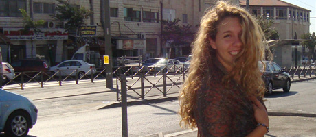
Echavarria was inspired to study urban planning and the way it impacts life in East Jerusalem as a first-year student when she took a University Writing course focused on the Israeli-Palestinian conflict. Her research for that course triggered her interest on how the built environment can not only reflect a conflict, but also be used as a tool for additional conflict. Last summer, she lived what she learned as an intern with the International Peace and Cooperation Center in East Jerusalem.
“From my time in East Jerusalem, I gained a first-hand understanding about one of the most studied conflicts,” said Echavarria. “I am more aware of how infrastructure is used and is often an extension of the city’s political history.”
According to Associate Professor of Geography Lisa Benton-Short, who served as Echavarria’s faculty mentor, the division of Palestinians and Israelis in the biblical city is of such long standing that it has become institutionalized in urban planning. Residents have learned to navigate the areas that are safe for them and to avoid the places that are not. In the process, they create mental maps of their city spaces.
“It is now expected that security measures such as fences, divides, and walls are planned into every new building or development,” said Benton-Short. “I don't see planners moving beyond that security mentality in how they plan for new developments or how they redevelop older areas anytime soon.”
Echavarria's academic background lent itself well to this particular project, providing her two essential tools: knowledge of both geography and international affairs.
“Through her international relations studies, Aurora knew how to examine the political conflict at both a regional and local scale; and as a geographer, she was sensitive to the impacts of this political conflict on the physical environment/geography of the city of East Jerusalem,” explained Benton-Short. “The core of geographic inquiry is the relationship between people and their environment, built or natural.”
Echavarria travelled abroad again this spring to study geography at University College London and take courses on the built environment at the college’s Bartlett School of Planning. Her research focused on the ways man-made structures and infrastructure impact how humans live.
“My experiences abroad have deeply influenced my way of thinking about future plans,” she said. “I would like to conduct similar research on environments of conflict and expand these ideas and studies to less conventional cities.”